GIS for Cities – Changes in the Last 5 Years
Geographic information systems (GIS) have been around for many decades. They are tools that allow for the manipulation and representation of data on a map. In fact, many larger cities have dedicated GIS departments.
They are popular in cities and can be used by almost any department for both internal and external users. For example, a city planning department will likely layer zoning data, official community plans, and sewer lines to assist with their processes.
Likewise, that same data, such as City of Surrey’s Cosmos system, can be used by property developers to make it easier for them to pass all regulations for development projects. This would be an example of a tool for external facing users.
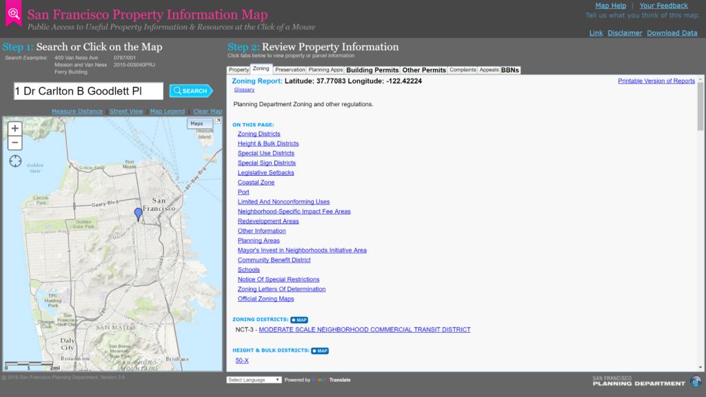
These tools come in all different shapes and sizes, both new and old. Here is an example of City of San Francisco’s Property Map tool that shows some of the same data as above

City of San Francisco’s Property Information Map
GIS solutions are expensive investments typically purchased by larger cities and counties with larger budgets. However, even in an era of tighter budgets and fiscal issues, there has been a large increase in the use of these tools by all types of governments.
From traffic to planning and economic development to engineering, demand for specific use cases of GIS tools continues to increase. A key reason GIS has become popular in government is that nearly 80 percent of all city information is address-based. This makes the technology very useful.
3 trends leading to changes
What are the larger trends that have allowed for GIS to finally reach all levels of government?:
1. Open data – Open data initiatives by cities, where cities publish data sets for public use, allow for more creative uses of mapping technology. The biggest users of open data portals can sometimes be other departments within cities.
2. Cloud technology – Software vendors, including startups that are part of the Civictech and Govtech movements, are building newer agile software solutions on the cloud, using clean user interfaces that are cheaper.
3. Open source – open source software is going mainstream and cities take notice. Unique startups and newer software vendors are able to build GIS using open source development. This allows for clean solutions that will have a large user base of support going forward. In fact, some governments are now mandating open source development
Expect to see more interesting use cases in cities as cloud based, open source GIS tools become more popular.


